 Kaid Benfield Archive
 The convenient solution to the inconvenient truth

Posted December 6, 2007 at 8:45PM
I wish I could claim credit for my friend John Norquist’s very catchy and apt description of smart growth and urbanism. (I did paraphrase it slightly - does that count?)
 John is the President of the Congress for the New Urbanism and a longtime former mayor of Milwaukee. When it comes to cities and land development, the man knows whereof he speaks. He’s also a great guy, and a terrific partner in this pesky little business of trying to change the world.
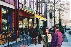
John points out, quite correctly, that close-in neighborhoods that are built to a walkable scale can reduce driving by 30-50 percent compared to exurban sprawl. And they can provide tons of convenience as well, with shops, services and amenities in walking or close driving distance.
Skeptical? Take a look at this map of metropolitan Atlanta, prepared by another friend, Eliot Allen of Criterion Planners. To get oriented, note that the map covers an immense multi-county area, stretching some 80 miles from its northernmost boundary to its southernmost boundary. I-295, the Perimeter highway that circles what used to comprise all of Metropolitan Atlanta, now describes only about a fifth of the map, in the center; the Perimeter, no longer aptly-named, is only about 10-15 miles across from east to west and 15-20 miles from north to south. Although some of the farthest fringes of the current metro area are still covered in farmland and forest, they are in the direct path of fast-approaching sprawl.
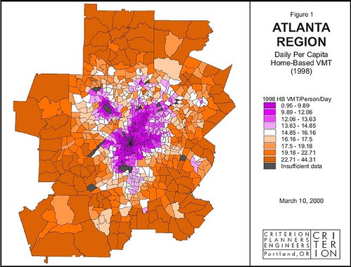
Here’s why building on those fringes is a terrible idea for the planet, and building closer to town is the way to go: residents of the areas on the map in dark orange drive, on average, five times more than residents of the dark purple areas, because the things they drive to are so spread out and there are no alternatives to driving. They drive twice as much as even the residents of the white areas.
A smart growth strategy, such as the one I wrote about for Ontario, would direct new growth into infill opportunities within the dark purple areas, into available land within the lighter purple areas, and perhaps very carefully into the white areas, depending on context. This would provide convenience to residents by cutting the time they have to spend in their cars by as much as half (or even more in ideal situations) compared to the sprawl locations and save gasoline and auto maintenance expenses, while helping save the planet, too.
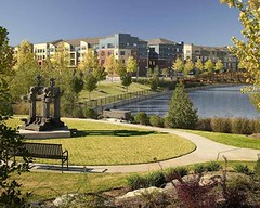 As I’ve been discussing in previous posts, another way that smart growth adds convenience is by putting people and at least some of the things they need to do within walking distance. An exhaustive study of travel habits in Atlanta measured the walkability of neighborhoods as determined by the connectivity of their street networks (cul-de-sacs limit walking routes, grid patterns provide options in more directions), land use mix (things worth walking to), and density (the scale of the neighborhood, are things spread out or more convenient to each other?). 37 percent of residents of “high-walkability” areas met the US Surgeon General’s recommended 30 minutes of moderate exercise daily, compared to just 18 percent of those in the “least walkable” areas.
And did I mention that this strategy helps save the countryside, too? How convenient is that?