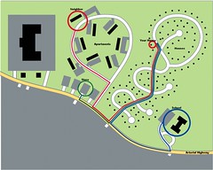
Retrofitting suburban cul-de-sacs: start with trails

Posted October 22, 2009 at 1:31PM
I've had a number of posts about the importance of street connectivity in promoting walking and cycling and shortening driving trips. The best of them was Rachel's terrific guest post, explaining the pitfalls when she was a kid trying to reach her friend's house.
 Typically, older city neighborhoods were built on a grid system and have decent connectivity: you have more than one way to get from point A to point B, and you can also get to points C, D, and E easily if you need to. But many newer suburbs are built with cul-de-sacs ("lollypop patterns") connecting only to a single collector road and then to a busy arterial. Even if the subdivision has sidewalks and places you might actually want to walk to, your ability to find safe and convenient walking options is sharply limited.
So, what to do? It is very difficult to build new streets to connect up existing dead ends, particularly given the typical pattern of multiple lot ownership in most subdivisions. Ellen Dunham-Jones and June Williamson, in their book Retrofitting Suburbia, are able to cite one example, but it is only a plan; and the housing involved is for military families (Laurel Bay, on Parris Island in South Carolina). As the authors concede, "built examples of connecting the culs-de-sac or other means of interconnecting existing residential subdivisions remain rare."
But could we at least connect them with walking paths? LEED-ND encourages just that under its Street Network credit, which provides credit for street connectivity only if 90 percent of any new cul-de-sacs are connected with walking or cycling paths. (LEED-ND also has other credits that discourage cul-de-sacs in general.) And now Tigard, Oregon (about 10 miles from Portland) is moving forward with a plan to designate and build 42 miles of connecting trails within existing neighborhoods.
An emphasis has been on designating and improving informal "desire paths" that already existed and were used by neighborhood residents, even though no formal public access had been established. The city and its contractor, Kittelson & Associates, established a wiki-based web site where residents could indicate on a map where such informal walkways were (see map). Nancy Friedman's website Fritinancy describes "desire paths" in a way that rings very familiar:
"Desire path: A term in landscape architecture used to describe a path that isn't designed but rather is worn casually away by people finding the shortest distance between two points.
"A close look at any city park or green will typically reveal footprints that break away from paved walks, trails that countless pedestrians have worn into the grass. Such a trail is a desire path: the route people have chosen to take across an open place, making a human pattern upon the landscape." (Citing Lan Samantha Chang , in Home Ground: Language for an American Landscape, edited by Barry Lopez and Debra Gwartney.)
Writing on Streetsblog, Mathew Katz reports that the Tigard Neighborhood Trails Project is intended "to make existing trails safer, and to build new ones to form a better overall network." It's a cool idea.
