What criteria should we use to define smart growth locations?

Posted February 24, 2010 at 1:32PM
There has been much discussion lately about which criteria policymakers should use to define “smart growth” or “location efficiency” for the application of policy. As all of us who have slaved over LEED-ND for the better part of a decade can attest, this is a very difficult issue.
Warning: This may be my all-time wonkiest post. Tomorrow’s will be easier to digest, I promise.
Basic principles and challenges
The problem is not that we don’t know what the principles are. We do: They are to (1) avoid sites whose environmental characteristics make them unsuited for intensive development; (2) favor locations within the existing developed area of a region and well-served by existing urban fabric and transportation choices; and (3) ensure that what is built in those locations is consistent with the goals of sustainability. In this post, I am going to concentrate on the first two of these, which pertain to development location (as opposed to what the new development will be, which I will only touch on). This is critical, because location (referred to as "regional accessibility" or "destination accessibility" in the analytical literature) is the single most important determinant of a development's energy performance.
 The challenge lies in defining locational parameters precisely enough so that implementing them will be consistent and effective, yet not so precisely that they require difficult calculations and unreasonable amounts of effort to apply. The challenge is complicated further by varying local circumstances and policy objectives. It’s become a policy cliché to say that “one size does not fit all,” but that is particularly true in this endeavor.
In LEED-ND, our typical deliberations would produce a straightforward proposed standard, but in the committee it would be immediately followed by the spinning of one hypothetical situation after another to show that the standard would unfairly exclude this or that good development site. I came to be comfortable with those exclusions, because to weaken the standard to accommodate outliers would in most cases undermine its effectiveness for the vast majority of circumstances. The goal should not be to include every site that might conceivably produce smart growth, but to write standards that produce a high degree of confidence in included sites’ environmental performance. Put another way, the goal is to include only those sites whose superior environmental performance can likely be guaranteed by standards. Inside or outside of LEED-ND, that remains the goal of smart growth criteria.
Borrowing from LEED-ND for policy
So all this was hashed out to a great extent in LEED-ND, providing policy wonks with at least one easy approach to selecting policy criteria. The most expeditious approach to defining good smart growth locations would be to borrow the standards of the rating system's “smart location and linkage” section, and write them into relevant policy instruments. While they are not perfect, policymakers would have the confidence that comes with tapping into an extensive, multi-party deliberation that has been tested and thoroughly vetted.
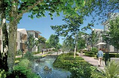 In particular, LEED-ND's prerequisites might be adopted as appropriate minimum standards, defining sensitive lands that should be avoided (habitat and ecologically significant lands, wetlands, floodplains, and certain agricultural lands), and using measures of basic urbanity (e.g., surrounding development, infrastructure, transit access, nearby neighborhood assets) to broadly describe sites likely to have better-than-average environmental performance.
To identify a location that is preferred and thus suited for policy benefits beyond those available to other development, an agency or legislator could adopt the “Smart Location and Linkage” section’s credit language in addition to the prerequisites and require that the site qualify for a minimum number of credit points (for example, 14 of the available 27) under its criteria. Rather than trying to define which points must be earned, this would allow the site’s proponent flexibility to qualify from an available menu that rewards good street infrastructure, brownfield remediation and adaptation, transit service richness, and/or proximity to existing jobs.
Excluding inappropriate sites for intensive development
If policymakers wish to avoid or go beyond LEED-ND, they should start with standards that ensure preferred development avoids encroaching on sensitive environmental and cultural resources. The criteria below are offered as examples rather than anything definitive, since adjustments may be appropriate in particular circumstances.
In particular, the Sustainable Sites Initiative’s prerequisites identify some appropriate categories of land where development should not be preferred:
- Prime farmland, unique farmland, or farmland of statewide importance
- Floodplains (for greenfield sites, the SSI allows only “minimal impact” development within the 100-year floodplain; previously developed sites within the floodplain may be redeveloped with limitations)
- Wetlands (areas within 100 feet of wetlands must be protected; only ten percent of the buffer may be developed with “minimal impact”)
- Areas found by a pre-design assessment to contain habitat for plant and animal species identified as threatened or endangered
I would argue for at least three more categories of land that should be protected from development:
- Areas designated as reserves by the federal, state or local government
- Places within public parkland (e.g., inholdings)
- Sites where building would involve demolition of officially designated historic buildings or alteration of officially designated cultural landscapes.
Identifying acceptable locations for development
Once the bad sites are excluded, the task becomes to identify the good ones. In particular, to avoid contributing to sprawl, a development must avoid “leapfrogging” by being within the de facto boundary of existing regional development. In addition, the closer a site is to the region’s core, or at least to the core of an established suburb, the better its environmental performance is likely to be.
There are no completely reliable measures of this, unfortunately, at least none that do not require elaborate calculation. So standards must rely on proxies. Three of them are (1) whether the site qualifies as infill; (2) the density of the surrounding, pre-existing road and street network; and (3) the density of the buildings surrounding the site.
In addition, we know that some sites may have adequate potential for smart development apart from their regional location because of transit richness and/or the proximity of neighborhood assets within walking distance. Not all good sites (especially minimally qualifying ones) will have all of these characteristics, however; so a menu approach, such as (but not necessarily identical to) that in LEED-ND, may be the most practical.
A beginning hierarchy to identify minimally nonsprawling development might look like the following:
- If the jurisdiction has a growth boundary, including advisory boundaries drawn in comprehensive planning, the site must lie within the boundary; and
- The site must have at least one of the following characteristics:
- It qualifies as infill (e.g., 75 percent surrounded by existing development).
- The lands surrounding site’s boundary have an ample, connected street/road network (e.g., land within 1/2 mile of the boundary must have streets containing at least 140 intersections per square mile).
- The lands surrounding the site (e.g., within a 1/2 mile distance from the site’s boundary) contain a base level of residential and/or commercial building density (e.g., an average residential density of seven or more dwelling units per acre, and an average commercial density of floor area ratio 0.5 or greater).
- There is regular public transit service with a base level of frequency (e.g., at least every 15 minutes during peak periods, at least every 30 minutes in non-peak periods, stops within convenient walking distance).
- The site’s boundary is within ¼ mile walking distance of at least five “neighborhood assets” (school, library, place of worship, pharmacy, supermarket, etc.) from a list of eligible diverse uses such as that contained in LEED-ND.
The choice of exact numbers for the above qualifications is far from an exact science, and the numbers may be modified as appropriate to varying locations and policy goals. For the most part, these particular numbers have been adapted from the LEED-ND prerequisites (though in LEED-ND the parameters tend to be more precise and complex).
Identifying priority locations eligible for special benefits
While the above standards would generally describe a site that is minimally acceptable, and likely preclude automobile-dependent, leapfrog sprawl, the bar should be raised to a higher level of environmental performance when substantial policy benefits such as financial incentives or fast-track approvals are available as a consequence.
For example, a hierarchy to identify preferred, special-benefit sites might require each of the following:
- Growth boundary: If the jurisdiction has a growth boundary, including advisory boundaries drawn in comprehensive planning, the site must lie within the boundary; and
- Surrounding development: The lands within a 1/2 mile distance from the site’s boundary must have a street/road network containing at least 200 intersections per square mile, or an average residential density of twelve or more dwelling units per acre and an average commercial density of floor area ratio of 0.75 or greater; and
- Transportation choices: There is regular public transit service with adequate frequency (e.g., at least every 10 minutes during peak periods, at least every 20 minutes in non-peak periods, at least 16 hours daily; bus stops must be within ¼ mile walking distance of the center, rail stops within ½ mile), or the site’s boundary is within ¼ mile walking distance of at least eight “neighborhood assets” from a list of eligible diverse uses.
I warned you it would be wonky. Again, the numbers are inexact, and may be varied according to circumstances and policy goals. These are examples. But the point is that a public agency dispensing special incentives or rewards should be assured that enough development is present to indicate a sufficiently urban environment and that the site is adequately served by either good transit service or a high degree of walkability.
What about the new development?
 While this discussion focuses on site selection, not new development intensity or design, policy benefits should not accrue to development unless the new development, too, exhibits the characteristics associated with superior environmental performance. These should include, at a minimum:
- Adequate internal residential and commercial density
- A mixed-use environment (supplied within the new development if not already present)
- A diversity of housing types and affordability conducive to a mixed-income neighborhood (see, e.g., LEED-ND’s NPD credit 4)
- An inviting pedestrian environment (see, e.g., LEED-ND’s NPD credit 1)
- Superior building energy and water efficiency
- Provisions for stormwater management
As noted, it is impossible to say that these are precisely the right measures for all situations. Readers should feel free to add to, subtract from, and modify them as appropriate. But they are based on research, experience, and deliberations, and even more important than the standards themselves is the method for constructing them: exclude the inappropriate places; use proxies to identify the appropriate ones, setting the bar according to policy goals; and describe the characteristics sought in the new development. I know many of you deal with these issues, so I hope this will be of some use as you think about them.
For much more detail on these topics, readers may wish to consult the LEED 2009 for Neighborhood Development Rating System, the Sustainable Sites Initiative: Guidelines and Performance Benchmarks 2009, and the "Smart Growth Tax Credit Act," Senate No. 2502, State of New Jersey, 210th Legislature (2003).
