Impressive Denver study on equity & transit should become national model

Posted May 4, 2012 at 1:28PM
Transit analysts Reconnecting America and the Denver equity coalition Mile High Connects have released an impressive compendium of maps and research showing how expansion of that city’s transit system could bring major opportunity to traditionally underserved populations – if local agencies take the necessary steps to prepare and coordinate. Called the Denver Regional Equity Atlas, the data-rich report is among the more sophisticated uses of GIS mapping that I have seen.
It should be immensely useful not only to city officials, advocates, planners and social scientists in Denver, but also to anyone looking for a state-of-the-art analytical model to assist the coordination of transportation, housing, jobs, and access to important services in other American cities. It must have cost a fortune to underwrite.
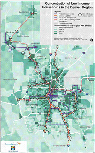
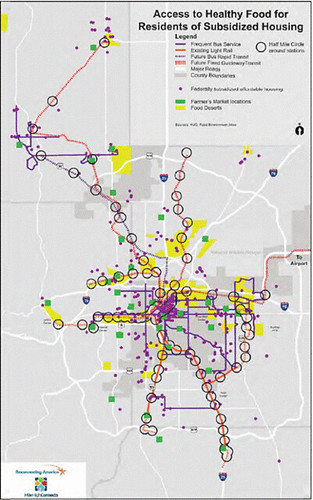
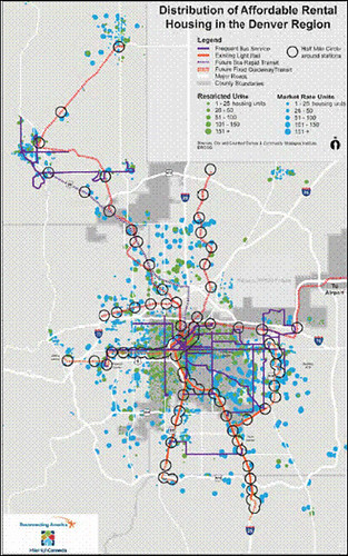
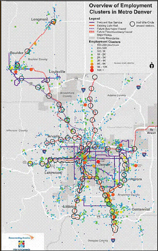
The Atlas comprises five chapters and 31 large-scale maps that cover demographics, housing, health, jobs and education; data were collected from a variety of sources for seven counties in the metro Denver region. Each map also shows the current and future transit network, including high-frequency bus routes and rail lines, enabling users to see quickly how well the transit lines and stops match up with, for example, concentrations of low-income populations, jobs, affordable housing, parks, shopping, medical services and the like. The report was co-written with the Piton Foundation.
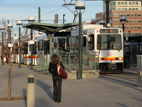
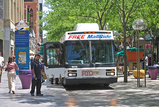
Denver’s Regional Transportation District is currently engaged in one of the country’s most ambitious expansions of public transportation infrastructure and services. RTD’s “FasTracks” Program is a multi-billion dollar effort to build 122 miles of new commuter rail and light rail and 18 miles of bus rapid transit, and to enhance current bus service for access and transfers across an eight-county district. It is already beginning to change the region by bringing more and better ways of getting around to more people, while stimulating walkable development around the rail stations.
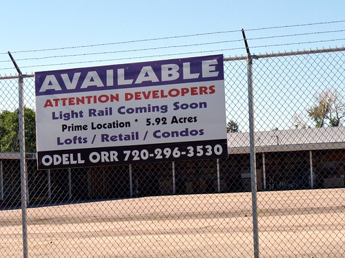
The potential for such substantial investment to be transformative is obvious. Within walking distance of most transit stations, communities across the region hope to build a mix of housing, office, shopping and other essential community resources in order to create a unique sense of place and reduce reliance on automobiles. But the authors make clear that it cannot be assumed that these benefits will accrue equitably:
“Improving access to opportunity via transit is especially important to households with lower incomes, who spend a greater proportion of their income on housing and transportation. Ensuring that transit-oriented communities remain affordable and inclusive is a major concern for those segments of the population who rely on transit the most. Moreover, making the connection between transit and important issues such as education, health and economic development requires significant capacity building and collaboration to help stakeholders and decisionmakers understand how better transit service combined with [transit-oriented development] can benefit the entire Metro Denver region.
“To help visualize the connections between the places people need to go and the transportation options available to them, Mile High Connects has created this Regional Equity Atlas, which maps the region’s major origins and destinations in relation to the current and future transit network, emphasizing the enhanced access to opportunity that transit will provide. The goal of this document is to help raise awareness about the benefits and opportunities that a robust public transportation network can create . . . [I]t will further build the case for why the Metro Denver region needs to focus on creating and enhancing access to opportunities through affordable transportation options and development oriented around these new transit lines.”
The report uses the data and maps to make very important points about the region’s future. These in particular stand out to me:
- “Last-mile connections” are essential to make transit a viable transportation alternative. Because many important destinations lie outside an easy walking distance from transit stations, “communities need to invest in pedestrian and bicycle infrastructure.”
- Many planned transit lines will traverse low-income neighborhoods, better connecting them to opportunity but also potentially disrupting them as demand for housing near transit grows beyond the supply and puts pressure on housing costs.
- Affordable housing is available in more places than people realize, but the majority of it is not near transit. As a result, preservation and creation of affordable housing opportunities near transit stations is critical.
- Healthy food options are limited along many transit corridors.
 Research should be undertaken to understand the industries and types of jobs located along major transit corridors in order to understand how transit access can be leveraged to promote employment.
 - Transit service to grocery stores should be increased and improved for people living in food deserts, and incentives should be provided to grocers to locate in station areas.
Research demonstrates that placing development near highly accessible transit service can dramatically reduce traffic and increase walking. But, in order to maximize benefits, we must give thought both to the content and layout of transit-served neighborhoods and to the design of transit facilities. A major undertaking such as that under way in Denver provides a fresh opportunity to get it right.
I've hit only a few of the highlights in this highly detailed report. According to Reconnecting America’s press release for the Denver Regional Equity Atlas, the organization has also been working on transit equity analyses in the San Francisco Bay Area, New York City, and Minnesota’s Twin Cities region. The Denver project certainly sets a high standard for what’s possible.
Related posts:
- Households in transit-oriented locations save more energy and emissions than even 'green' households in sprawl (February 24, 2011)
- "Equity is the way forward" - discussions on race and America's future (November 4, 2010)
- Taking revitalization to the next level: Denver’s Living City Block (March 11, 2010)
- A local lesson in transit orientation, walkability and supermarket economics (March 8, 2010)
- Transit-oriented development requires more than transit and development (January 25, 2010)
Move your cursor over the images for credit information.
Please also visit NRDC’s Sustainable Communities Video Channel.
