We must pay more attention to coastal development and sea level rise

Posted January 27, 2009 at 1:18PM
I spend most of my professional time thinking about where development should go, where it shouldn't, and what form it should take. A lot of my thinking is derived from wanting to reduce transportation impacts from sprawl and also to conserve as much of the rural and resource landscape as possible. And, like any decent environmentalist, I want development to avoid environmentally sensitive areas like wetlands and erosion-prone slopes except in very limited circumstances.
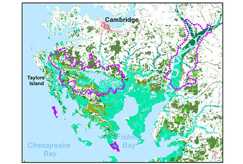
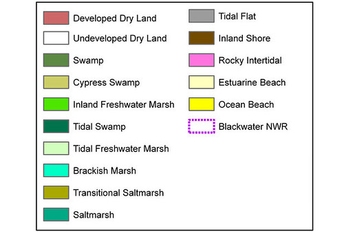
Courtesy of an article in The Washington Post by Juliet Eilperin, and some time on the web site of The National Wildlife Federation, I got a wake-up call over the weekend with regard to the latter. NWF has produced some revealing maps showing the effect of sea level rise due to global warming. Here is the area of Maryland's Eastern Shore around the Blackwater National Wildlife Refuge. White indicates dry land, blue indicates open water, and shades of green indicate categories of wetlands, as noted on the legend below:
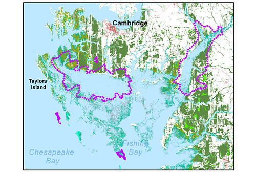
Now look at the same area in 100 years, after 27 inches of sea level rise:
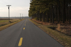
That is frightening. I've been to Blackwater and enjoyed it. You can bike or drive around its quiet roads (see below) and view all sorts of waterfowl and some other critters, too. But, in a century, there will be no roads.  The entire refuge will be underwater, just about, and the villages currently on the peninsula extending south from Blackwater will themselves be either underwater or converted to marsh. (So, apparently, will be at least some parts of the city of Cambridge.) Yikes.
Eilperin's article makes clear (as do the maps) that sea level rise poses enormous challenges for conservationists thinking about how to preserve ecological communities when their current boundaries are likely to disappear. I'm thinking it also needs to affect where and what we build in coastal areas, and we in the smart growth community need to pay more attention.


