What good, grassroots advocacy for complete streets looks like

Posted May 3, 2013 at 1:28PM
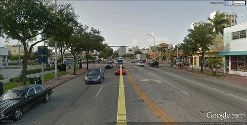
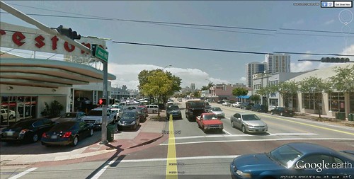
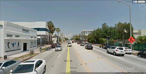
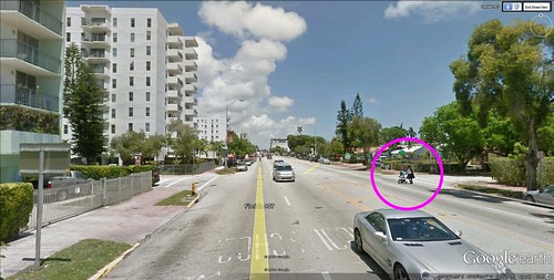
I took a tour of Miami Beach this morning. No, not in person (though I wish), but via the wonders of Google Earth. And I didn’t see South Beach, the grand hotels, or the ocean, for that matter. So what was the point?
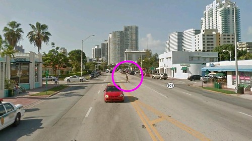
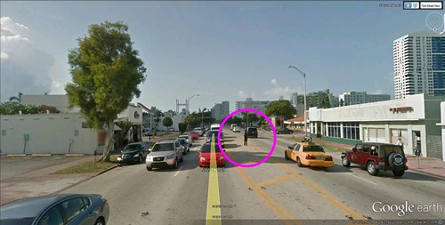
I wanted to see a stretch of road on the backside of the community – away from the Atlantic – that is being reconstructed by the Florida Department of Transportation. It’s a 1.3-mile stretch of Florida Route 907, known locally as Alton Road. My first set of impressions varied from it’s nondescript, to it’s chaotic, to it’s every road in America, to “are you kidding me, it’s sunshine and palm trees, where’s the beef?”
But, as I looked closer, I noticed the stranded pedestrians. They wouldn’t be in the middle of the roadway if they were better accommodated, and I even felt frightened for one or two of them. This is not an easy road to cross conveniently. And, to tell the truth, it doesn’t even look that pleasant to drive on. Isn’t the reconstruction – required mostly for flood control – an opportunity to make it work better for everyone with a “complete streets” approach?
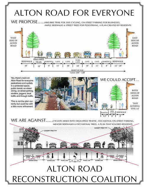
That’s exactly what a grassroots group called the Alton Road Reconstruction Coalition thinks. I love the graphic below, which sets out the possibilities and the coalition’s position about as clearly and sensibly as I’ve seen. What they are proposing wouldn’t cost that much more, if anything, and it would make both the road safer and that part of the community more pleasant to be in. There are all sorts of wins here, and no real losses that I can see. It’s a terrific example of how to do local advocacy, in my opinion.
Take a look at the coalition’s website to learn more. There’s more detail, but the citizens’ proposal includes the following:
- Wide sidewalks
- Hike / Bike trail for runners and bikers on the west side of Alton
- Narrow driving lanes to slow traffic and allow for more sidewalk space — 10 ‘ vs. 11′
- More shade trees
- Center island medians to allow a refuge for pedestrians and planting space for shade trees
- 30 MPH speed limit
- More parking
- Pedestrian crossing signals at all intersections
It’s a great concept as is, but I would urge that they consider a few improvements to the proposal. In particular:
- This is at least partially about flood control. Why not add some green infrastructure in the form of pervious pavers in the sidewalks and crosswalks, and with sophisticated landscaping specifically designed to absorb rainwater? It makes sense to work on complete streets and green streets at the same time. By the way, some of this may be implicit in the proposal; if so, I would highlight it so the DOT has to respond.
- The illustration does show pavers in the bike lanes. That’s the wrong place for them. Bumpy pavement is OK for pedestrians but horrible for cyclists, and wet pavers are especially slippery for bicycle tires. Keep the bike lanes smooth.
- I also would not encourage runners and cyclists to use the same space, particularly a two-way space, as seems to be the proposal here. That diminishes the experience for both and is an accident waiting to happen, especially since so many runners wear headphones while they are out and can’t hear warnings.
Those are minor tweaks, though. On the whole, this is a great idea and very well presented. Let’s hope the coalition gets the results they and the community deserve.
Thanks to Wanda Mouzon for bringing this issue to her friends, including me.
Related posts:
- Streamlining the process for people-oriented streets (June 26, 2012)
- Fixing suburbs with green streets that accommodate everyone (December 20, 2011)
- How green infrastructure is making cities more sustainable & hospitable (October 11, 2011)
- Complete streets policies are gaining popularity across the country (April 27, 2011)
- Accommodating the multiple purposes of streets (video) (January 28, 2011)
- Hi, I'm Kaid, proud to be an 'avid cyclist' (March 26, 2010)
- Streets for seniors: a video look at issues and remedies (July 1, 2009)
Move your cursor over the images for credit information.
