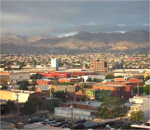
Could El Paso become a model of thoughtful smart growth planning?

Posted January 20, 2011 at 1:31PM
If you’re looking for a good example of thoughtful, place-based planning for transit-oriented development (TOD) in a location not yet known for it, you could do a lot worse than Connecting El Paso, a 264-page tour de force vision for parts of the west Texas border city. The plan was unanimously approved earlier this week by the El Paso city council and described by council member Beto O'Rourke as likely to "result in historic change" for the growing community.
It is certainly impressive. Connecting El Paso emphasizes that TOD is actually not a new idea in the city, which once had a streetcar system supported by walkable neighborhoods along its corridors. Now, with a new bus rapid transit (BRT) system and possibly a new streetcar in the city’s future, there is the opportunity to restore lost urban fabric and concentrate on a human-scaled smart growth strategy:
“Reactivating pedestrian life is the least costly, most reliable, healthy, and even most pleasant, of transportation options. This requires networks of safe, comfortable, interesting and walkable streets that are connected over long distances by public transit options that are both efficient and dignified. A variety of transit options should include trolleys, bus rapid transit systems, city buses and bicycle routes in addition to the private automobile system. Successful pedestrian environments must be planned in conjunction with transit planning – each depends on complete, compact, mixed-use communities."
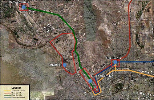
Well said. Connecting El Paso focuses on three parts of the city that are expected to undergo new development as a result of the BRT plan: Remcon Circle, Five Points, and the Oregon Corridor. The plan also proposes development of a 450-acre former industrial site near the city center.
The process was led by Dover, Kohl & Partners; among others working on the exercise was Urban Advantage, NRDC's partner in Picturing Smart Growth. Because these four districts are different from each other in character, the plan's details comprise a variety of approaches to smart neighborhood-building. Collectively, the four “small area plans” in Connecting El Paso can be considered as a first step to a major update to the city’s comprehensive plan.
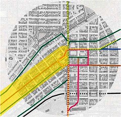
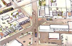
There is certainly a lot to be done. Consider the Five Points district:
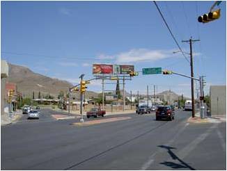
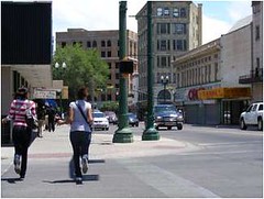
On the left above is the street framework, with the new BRT lines shown in yellow (the route is approximate in the west side of the image), along with existing transit lines. On the right is what the key intersection looks like today.
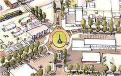
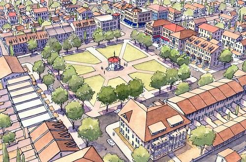
This is how that intersection could evolve from a haphazard, car-dominated site into a walkable TOD:
Connecting El Paso is clear about the city's need for a new vision:
“El Paso is experiencing robust growth, fueled by the expansion of Fort Bliss, the immigration of people and capital from Juarez, the birth of the first medical school anywhere in America in the last 30 years, and a buoyant local economy amidst a national financial crisis. The attractions are obvious– a benevolent climate, friendly people, striking landscape, cosmopolitan atmosphere, career opportunities, proximity to Mexico, and a high quality of life within a bustling city.
“As El Paso enters this historic period of growth and change, it is important that new development and investment enhances its character and makes the City even better, rather than worse. For the El Paso community to create a shared definition of “better” and to build consensus for its future direction, the City initiated a City-wide Comprehensive Plan update. Small area plans are the first stage of the Comprehensive Plan update, looking in detail at particular areas of the City that are under the pressure of growth and change in the short term or are in need of revitalization.”
The plan is the result of a year-long process involving a multi-disciplinary consultant team and the involvement of hundreds of El Paso residents with, according to the city, “close support from Senator Eliot Shapleigh; Roberto Puga, trustee for the [industrial] ASARCO site; and the Texas Department of Transportation.”
The work included an intensive, two-week charrette with property owners, neighbors, merchants, developers, and community leaders. The city provided a translator at all public events, so that Spanish-speaking residents could participate comfortably in the process. One of the appendices is a very interesting survey of community residents' current transportation habits and aspirations.
Taking advantage of what is already in place, the plan builds upon models from some of the city’s healthier areas, such as the historic neighborhood of Sunset Heights, above left, and the walkable downtown, above right.
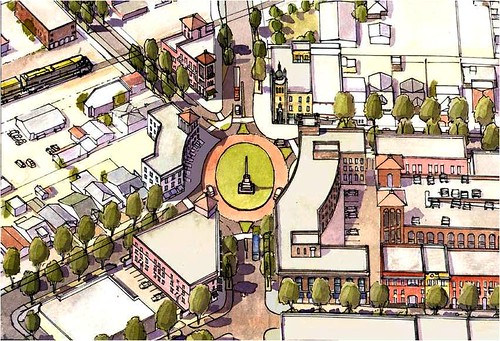
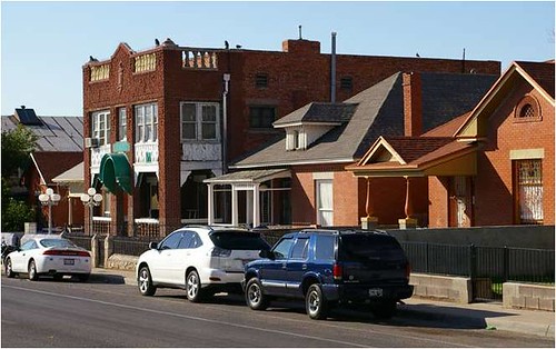
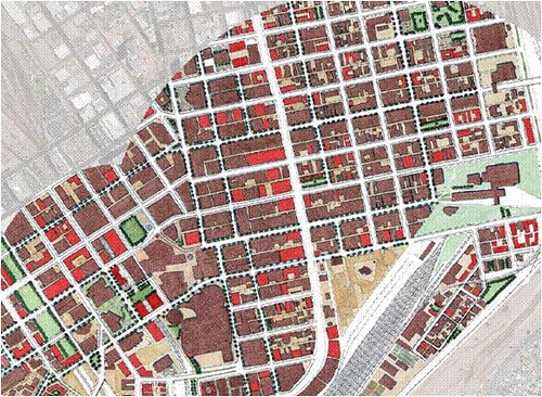
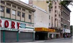
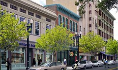
The image above illustrates how downtown El Paso (existing buildings in brown) could be enhanced with infill (vacant spots in the building fabric are shown in red), street trees and green space (note, for example, the small green pedestrian passageways shown in the upper right quadrant). The before-and-after photo and image below show how a related technique, adaptive reuse of existing buildings, can make for a more functional and attractive streetscape:
The plan’s emphasis on downtown revitalization is emphatic:
“El Paso’s Downtown is an overlooked urban design treasure that must be promoted in order to establish stable economic prosperity for the region. Investment in the Downtown in the early 20th century created a vibrant urban fabric with a mix of uses, street-oriented buildings, proud architecture of distinctive character, and numerous public and civic gathering spaces . . .
“The first priority for the City should be reinvestment in the Downtown. Although perhaps not intentional, City priorities and subsidies have been focused on growth and expansion at the edges, rather than on infill and redevelopment in the Downtown and historic neighborhoods.”
“A first step will be to redirect current policies that reward sprawl development, in favor of redevelopment and infill in the City’s center. This shift in policy will enhance the City’s most valuable asset, increase livability in the historic core, and will create a strong base for transit expansion throughout the region. The redirection of City priorities and policy is a critical first step in creating a sustainable and coordinated series of vibrant, transit-oriented nodes throughout the City.”
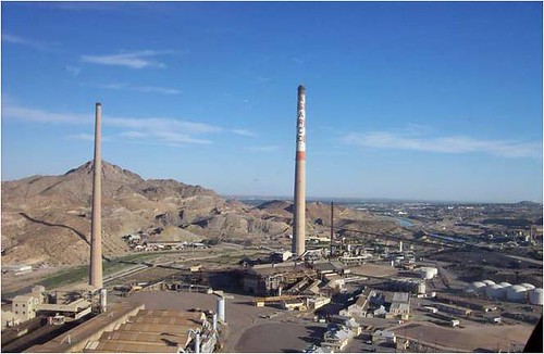
The ASARCO site, former home to a lead smelter and a number of minerals processing operations, deserves special mention. Because of regulation governing re-use of formerly contaminated sites, development will be restricted to nonresidential purposes in one of its four roughly equally sized areas; this will present a number of creative challenges, options for which are discussed in the plan. Other portions, however, are currently undeveloped and present a sort of fresh canvas to work with. As implementation proceeds, it will be important that development of currently undeveloped land not be allowed to compete for investment and siphon resources away from the first priority of restoring downtown and historic neighborhoods.
If I have a quibble, it is that I would have liked a chapter devoted to the demand for affordable housing and how the proposals meet it. There is some discussion of the issue with respect to how El Paso for the most part escaped the inflationary housing bubble that plagued other cities in the last decade, and regarding the advantages of zoning for accessory dwelling units. The analysis identifies a need for a larger portion of rental units within the region's housing mix, and there is demographic assessment for each of the four planning zones. But the plan would be even more impressive as a national model if it connected the dots and addressed the issue in a more straightforward and deliberate manner, since maintaining affordability in the catchment areas of transit stations is an issue of concern in many locations across the country.
A blog post can’t possibly capture all the rich detail of Connecting El Paso, which is meticulous on such subjects as walkability, street connections, public spaces, complete streets, environmental remediation, green stormwater infrastructure, community character, further transit investment, historic preservation, public policy needs, and even the application of LEED-ND. More than just a collection of area and TOD blueprints, this document is nothing less than a comprehensive guide to smart growth design and implementation in a major US (and international) city.
It must be said, however, that the sorry history of land use in America is littered with terrific plans that for one reason or another were not implemented to their potential or, worse, overridden and fractured by ad hoc amendments. This is long range stuff that will require sustained financial capital and political will over decades to succeed. The plan itself, for the most part, will not enjoy the force of law, though the city's recently adopted form-based code will at least provide a good deal of enabling authority.
That said, it is hard to imagine a much better vision to begin with than Connecting El Paso. When this year’s architectural and planning awards are handed out, look for it among the likely honorees.
Move your cursor over the images for credit information.
