Augusta's new master plan for revitalization looks like a winner (by Lee Epstein)

Posted October 16, 2013 at 1:26PM
Today’s post is authored by my friend and frequent collaborator, Lee Epstein. Lee is an attorney and land use planner working for sustainability in the mid-Atlantic region.
For some, the city of Augusta, Georgia conjures up a gently rolling golf course with manicured greens, devilish sand traps, and a golf tournament that ends with someone being fitted with an (let’s face it) ugly green sports coat. For others, it is home, Georgia’s third-largest city. (Note from Kaid: celebrated Augusta natives include Ben Bernanke, Hulk Hogan, and the Godfather of Soul, Mr. James Brown himself.)
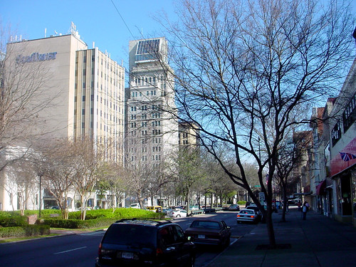
Like other urban regions in Georgia, development sprawls extensively and with little distinguishing character, but the city itself is still known for some significant medical institutions and a health-related university, a very pleasant and pretty Riverwalk, the Augusta Common, and a grid street layout designed by James Oglethorpe almost 300 years ago. The city also hosts eight separate historic districts.
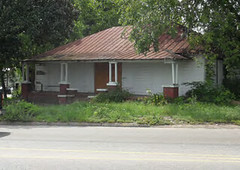 Unfortunately – due in part to the unmitigated spread of automobile suburbs – the city itself has faded, and its partly vacant downtown is replete with some pretty sad streets, empty stores, and some residential neighborhoods that have seen better days. (For example, according to the planning study detailed below, there were more than 500 vacant residential properties within the study area as of mid-2013.)
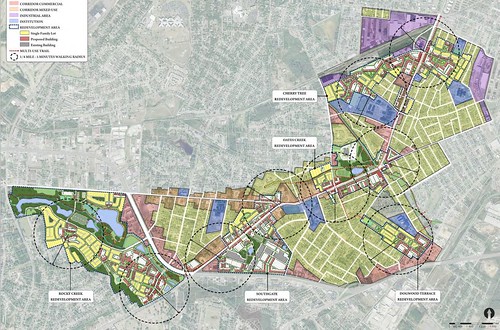
What to do? Using a challenge grant from the US Department of Housing and Urban Development under the Partnership for Sustainable Communities involving HUD, EPA, and the US Department of Transportation, the Augusta Sustainable Development Implementation Program has undertaken an intensive planning process to revitalize some parts of central Augusta that have declined. The planners have tried to directly engage as many in the community in the process as they could, while guarding against the usually deflating “it’s just more planning” description. The results so far have been impressive not only for process and the resulting conceptual design but also for detailed plans for implementation.
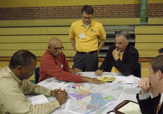
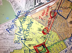
An intensive community charrette, for example, allowed citizens to suggest their own design ideas; a visual preference survey gave participants the opportunity to vote on the kinds of places they would most like to see built. Overall, the project is about uplift and upgrade, economic development and revitalization, improved transportation and neighborhood amenities, green space and design. Importantly, it’s about implementing these things, not just “envisioning” or planning them.
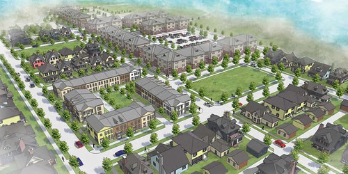
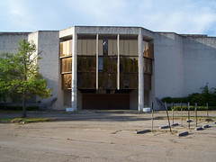
Several urban neighborhoods just southwest of downtown would be affected, along the once-busy, 4.5 mile-long corridor of Dean’s Bridge Road, from the eyesore of abandoned Regency Mall (like so many elsewhere) in the Rocky Creek neighborhood, onto 15th Street in the Cherry Tree neighborhood, and along the rail yards. The old mall, for example, would be converted into a mixed-use village center, while the neighborhoods along the route would incorporate all the necessary elements and basic services of a busy, active community, in focused nodes: grocery stores and farmers’ markets, restaurants and small shops, medical offices and the like.
Higher densities and mixed-income housing at appropriate infill locations would help make the economics of these new land uses work, but lower-density, single family homes and neighborhoods nearby would be protected.
 Accessibility to the new destinations is key. Many elderly and moderate income residents don’t drive, so enhanced public transit and walkability, with shaded sidewalks and places to sit, well-marked crossings with adequate pedestrian islands and landscaped medians, and a streetscape of continuous interest, are to be built into the mix. For those who can take advantage of more active transportation systems, bike lanes would be implemented. The corridor would also contain a comfortable new transit center, where an old bus transfer station is now located, and the big box center currently around it would be converted into a pedestrian-friendly commercial village.
What else is envisioned? Parks and green spaces, playgrounds, and public art would enliven and enrich the environment, and the corridor would be organized around a series of distinct, walkable, mixed-use centers.
Commendably, the planning team for this project went much further than these kinds of studies usually do, in an attempt to identify detailed means for implementing the plan. Neighborhood by neighborhood, precise changes to the City’s Comprehensive Plan are recommended, as are changes to the Zoning Ordinance. Additional recommendations include very specific transportation improvements – including pedestrian and bicycle projects; recommendations for the acquisition of land and development of public parks in particular places within the neighborhoods; various environmental changes, and green stormwater management improvements; and additional sustainability initiatives. Even specific catalyzing projects are recommended for each neighborhood.
Most impressively, an “action plan” is fully articulated, with the estimated costs of all these specific proposals, when they need to be accomplished and by whom, and what funding sources are potentially available. Even potential public and private sources, mechanisms, and investment vehicles are identified for public redevelopment activities, from financing via certain private funders and foundations, to state and federal tax credits. Regulatory processes and means for dealing with the difficult problem of vacant housing units is also discussed.
I can’t speak for how Augustans view this project – whether it was participatory enough, realistic enough, or is deemed adequately fair and equitable. But from the outside looking in, it certainly appears that the City and its consultants should be very proud of this thorough roadmap. With a lot of pluck and a little luck, it may well point the way toward a real opportunity for a stronger, more sustainable future – which is, after all, what it was created to do.
Other recent articles from Lee Epstein:
- Whither intelligent vehicles and automated highways? (with Lee Epstein) (June 17, 2013)
- Is there a way to (downtown) San Jose? (by Lee Epstein) (May 6, 2013)
- The essential elements of green cities (by Lee Epstein) (April 3, 2013)
- Meet the nation's biggest landlord (and developer) (with Lee Epstein) (February 6, 2013)
- Could Buenos Aires be a model for thinking about US cities? (by Lee Epstein) (January 10, 2013)
Move your cursor over the images for credit information.
.
